
Outdooractive. Hike and Ride
com.outdooractive.Outdooractive
by Outdooractive AG
Screenshots


Ad slot: Top Leaderboard
About this app
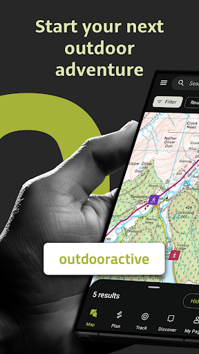
Confidently explore the great outdoors with Outdooractive - Hike and Ride: The most reliable outdoor navigation app, as trusted by thousands of trail wardens, mountain guides and outdoor industry professionals worldwide.
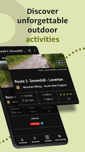
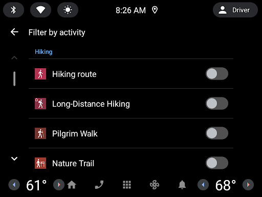
The Outdooractive - Hike and Ride app helps you find officially approved routes near you and around the world, with suggestions for dozens of sports including: hiking paths, trekking trails, mountain biking routes, trail running paths, ski touring routes and more. Or plan your own routes using the deepest catalog of official maps to take adventures into your own hands.
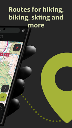
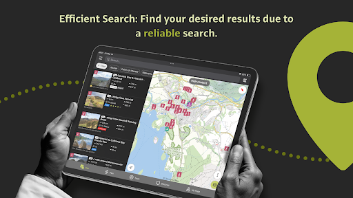
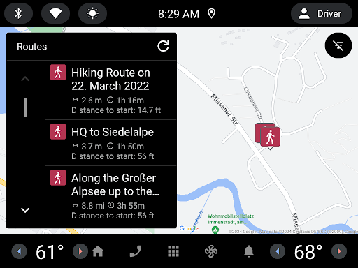
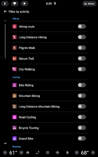
● Find routes you can rely on: Browse thousands of officially-approved routes near you and across the world, including routes for hiking, road cycling, bike touring, ski touring, gravel riding, trail running, horseback riding, mountaineering and more.
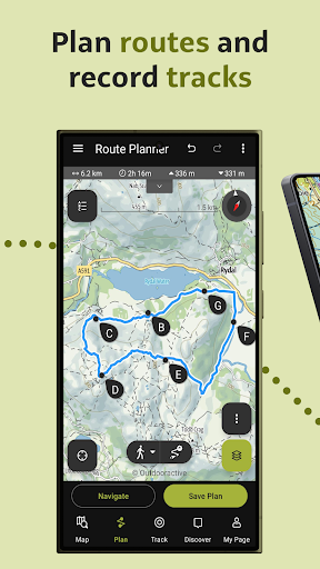
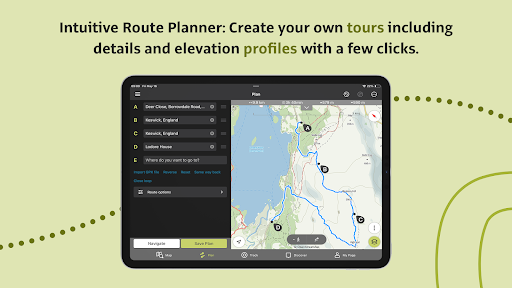
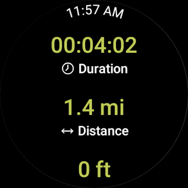
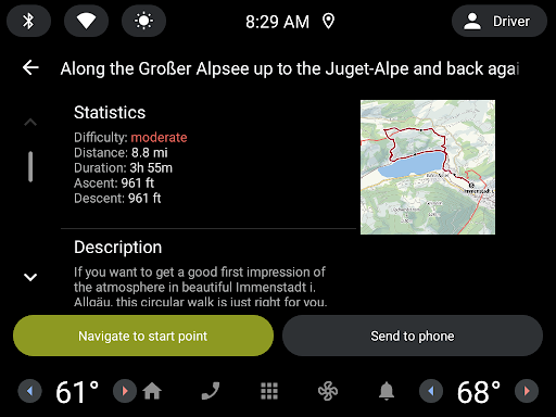
● Plan your own routes with tools trusted by professionals: Easily plot your own outdoor routes in the route planner in just a few taps, and see all need to know distance, elevation and terrain info.
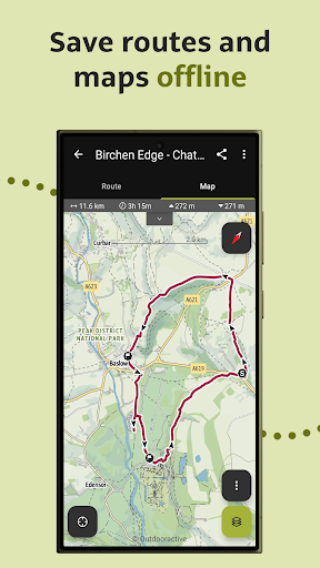
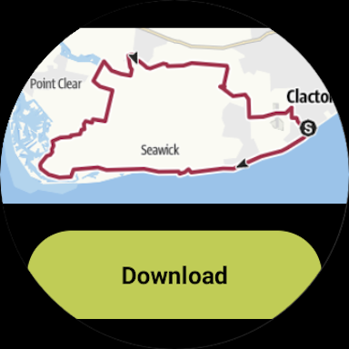
● Save everything offline: Save individual plans or entire areas offline for reliable navigation when you don't have a phone signal.
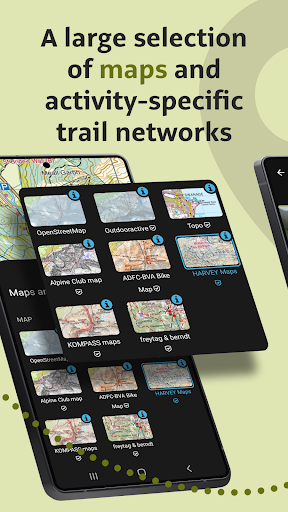
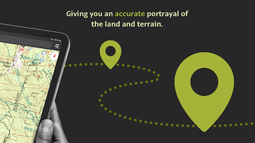
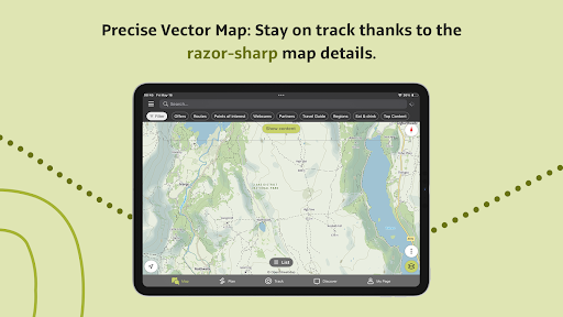
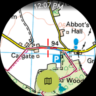
● Navigate with the most reliable maps on the planet: Browse the deepest collection of different map types to track or plan your adventures with confidence. Simply switch between different layers to get a clearer picture of the terrain you're planning to visit, and get the most reliable understanding of conditions on the ground. Outdooractive's map catalog currently includes:
- Official topo maps in 25 countries, including:
• Ordnance Survey (Landranger & Explorer) in the United Kingdom
• New Zealand Land Information in NZ
• USGS in the USA
• BKG in Germany
• BEV in Austria
• Swisstopo in Switzerland
• IGN in France
• CNIG in Spain
• PDOK in the Netherlands
• Kartverket in Norway
• Kortforsyningen in Denmark
• Lantmäteriet in Sweden
• Finland National Land Survey in Finland
• GSI in Japan
• Harvey Maps in the UK's most mountainous areas
- The official Alpine Club maps for climbing in the Alps
- The specially-designed Outdooractive map across France, Germany, Austria and Switzerland.
● Share your live location with family and friends: Give yourself and your loved ones complete peace of mind when you're out in the great outdoors thanks to BuddyBeacon.
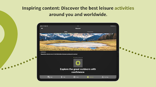
● Join a global community of outdoor tourists and adventurers: Share your activities with the community, join challenges to stay motivated, and get inspired by officially-approved content from our thousands of industry partners.
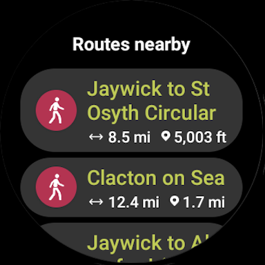
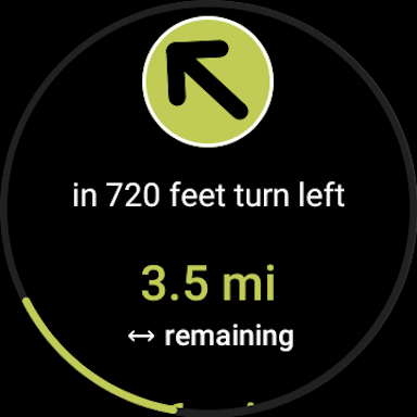
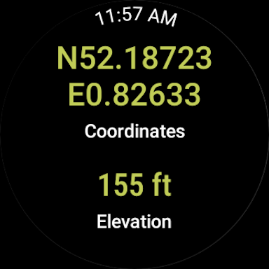
● Smartwatches with WEAR OS from Google: With a glance at your Smartwatch, you get information about your GPS position on the map. You can record tracks, get tracking data and navigate along routes.
FAQs:
Can Outdooractive find walking trails near me?
Outdooractive helps you find walking, hiking, cycling and many more types of trails both in your area, and around the world.
How can I find hiking trails near me?:
Using Outdooractive, you're able to find hiking trails in your local area by opening our app and browsing the map. You'll be able to see hiking trails with a range of distances, difficulties and distance from your location.
How do I know which hiking trails close to me are best to follow?:
Using Outdooractive's multiple map layers, you're able to view official information from multiple sources, to inform you about trail conditions, rules, restrictions and what to expect on your hike. Experts will share information on each route on its difficulty, required experience level and more!
Can I download offline maps to navigate nature walks and areas to hike near me?:
Outdooractive allows you to download maps and routes to your device before heading out, to help you navigate those areas where signal isn't guaranteed — allowing you to reliably navigate the outdoors.
The Outdooractive - Hike and Ride app helps you find officially approved routes near you and around the world, with suggestions for dozens of sports including: hiking paths, trekking trails, mountain biking routes, trail running paths, ski touring routes and more. Or plan your own routes using the deepest catalog of official maps to take adventures into your own hands.
● Find routes you can rely on: Browse thousands of officially-approved routes near you and across the world, including routes for hiking, road cycling, bike touring, ski touring, gravel riding, trail running, horseback riding, mountaineering and more.
● Plan your own routes with tools trusted by professionals: Easily plot your own outdoor routes in the route planner in just a few taps, and see all need to know distance, elevation and terrain info.
● Save everything offline: Save individual plans or entire areas offline for reliable navigation when you don't have a phone signal.
● Navigate with the most reliable maps on the planet: Browse the deepest collection of different map types to track or plan your adventures with confidence. Simply switch between different layers to get a clearer picture of the terrain you're planning to visit, and get the most reliable understanding of conditions on the ground. Outdooractive's map catalog currently includes:
- Official topo maps in 25 countries, including:
• Ordnance Survey (Landranger & Explorer) in the United Kingdom
• New Zealand Land Information in NZ
• USGS in the USA
• BKG in Germany
• BEV in Austria
• Swisstopo in Switzerland
• IGN in France
• CNIG in Spain
• PDOK in the Netherlands
• Kartverket in Norway
• Kortforsyningen in Denmark
• Lantmäteriet in Sweden
• Finland National Land Survey in Finland
• GSI in Japan
• Harvey Maps in the UK's most mountainous areas
- The official Alpine Club maps for climbing in the Alps
- The specially-designed Outdooractive map across France, Germany, Austria and Switzerland.
● Share your live location with family and friends: Give yourself and your loved ones complete peace of mind when you're out in the great outdoors thanks to BuddyBeacon.
● Join a global community of outdoor tourists and adventurers: Share your activities with the community, join challenges to stay motivated, and get inspired by officially-approved content from our thousands of industry partners.
● Smartwatches with WEAR OS from Google: With a glance at your Smartwatch, you get information about your GPS position on the map. You can record tracks, get tracking data and navigate along routes.
FAQs:
Can Outdooractive find walking trails near me?
Outdooractive helps you find walking, hiking, cycling and many more types of trails both in your area, and around the world.
How can I find hiking trails near me?:
Using Outdooractive, you're able to find hiking trails in your local area by opening our app and browsing the map. You'll be able to see hiking trails with a range of distances, difficulties and distance from your location.
How do I know which hiking trails close to me are best to follow?:
Using Outdooractive's multiple map layers, you're able to view official information from multiple sources, to inform you about trail conditions, rules, restrictions and what to expect on your hike. Experts will share information on each route on its difficulty, required experience level and more!
Can I download offline maps to navigate nature walks and areas to hike near me?:
Outdooractive allows you to download maps and routes to your device before heading out, to help you navigate those areas where signal isn't guaranteed — allowing you to reliably navigate the outdoors.
What's New
In this version we fixed some bugs and made some performance improvements.
Do you have any questions or suggestions? Shoot us an email to [email protected]
Your Outdooractive Team
Do you have any questions or suggestions? Shoot us an email to [email protected]
Your Outdooractive Team
App Information
Version Name
3.16.9
Version Code
3874224
File Size
27.3 MB
Min SDK
Android 24+
Target SDK
Android 33
Developer
Outdooractive AG
Contact
Website
Content Rating
Everyone
Package Name
com.outdooractive.OutdooractivePermissions Required
This app may request the following permissions:
Recent Reviews

Jeff Zaleski
1.0★
Terrible both in form and function. Used VR until the day it was shut down, then cursed this "replacement" for the next 3 days of hiking. It would randomly zoom out to continent scale and stop tracks. Distance traveled has been moved to a small status bar and only displays ft/m units, which is worthless on a multi-mile hike. So much more that just doesn't make sense for the backcountry user. Will gladly pay subscription fees for CalTopo to get a usable GPS interface.

Dave Marcellis
2.0★
The selection of maps is underwhelming. Viewranger had licensed the latest USGS maps and a selection of osm maps that were very useful. I got my thirty day free pro subscription and there's really nothing available that's close. The USGS maps are so old they show highways that were demolished in the mid sixties. It's totally useless for my purposes. In addition, viewranger would show the altitude provided by the metadata for any point on the map, this app only uses gps for the current point.

Duncan Fletcher
1.0★
This is not a replacement for VR. In VR, I had a great screen where I could view riding parameters (speed, distance, time of day, etc.) in large clear contrasting letters (viewable in sunlight with sunglasses). Parameter screen was customizable. Gone with no replacement. I will be deleting this and looking for another suitable app. This is useless for my purposes.

Kara
1.0★
So basically you forcibly shut down your popular free app in order to cram it full of in-app-purchases, putting the features anyone would actually use behind paywalls, that about sums it up? SMH. This is why I immediately disregard any app that has in-app-purchases of any kind. I'm going to stick to paperback trail guides. Those at least I can tear pages out for TP or to start a fire once you've read that page, so if more value than your app.

Stephen Pack
2.0★
After all the notifications about View Ranger migrating over to this app, I figured I'd finally give it a try, and it looks like I'm as disappointed as everyone else who was a loyal VR user. The ability to download small map areas for free seems entirely gone, now you must pay the recurring fee, and this was the most important feature for me. Uninstalling.

John Rozmus
5.0★
This is the app you're looking for if you want a GPS tracking map displayed on your smart watch (for free). I tried all of the other popular and recommended apps and none of them seem to have this feature, which I think is the most important feature of a wearable navigation app. For that reason alone, I rated this a 5/5, but the app also has a great interface, all the data you'd want, and many other great features. It does not have as good of a trail/route database as Alltrails.
Ad slot: In-Content